
Lawrence Township Street Directory Walkthrough
A Lawrence Township street directory is most dependable when it follows the address from one custodian to the next. Recorded ownership is public through the assessor and deed index, but it is not the same fact as current presence at an address. Begin with a full street number, road name, and municipality. Keep the situs address, or physical parcel location, separate from any mailing address returned by an assessment record. Then retain the block and lot, because those legal parcel identifiers survive changes in how a road or postal place is written.
- Ask the Lawrence Township assessor for the MOD-IV Street Index or a property record using the street address. Record the situs, mailing address if present, and block and lot as separate fields.
- Use the address in NJGIS, select Mercer County and Lawrence Township, and view the parcel geometry and available map layers.
- Search the block and lot in the Mercer County Clerk index to find the latest deed, its instrument number, legal description, and recorded parties.
- Work backward through a grantor and grantee trail only after matching the parcel and date. A recorded party is not automatically an occupant.
- For a dated address question, consult a Princeton-area criss-cross volume or other historical directory at the library, then compare its edition year with the deed and parcel record.
That sequence turns a street search into a dated record trail instead of an invented roster. The assessor, map, Clerk, and library each answer a different part of the question.
Lawrence Township Address Keys
Four keys appear in a useful Lawrence Township street directory search. USPS formatting is for delivery. The situs address drives assessor, GIS, map, and permit work. Mercer County uses municipality, block, and lot for the strongest deed bridge. Older directories may preserve a historical road spelling or postal label. A legal description is the parcel wording used in recorded instruments, and it can succeed when a modern street search fails.
- Parcel
- A defined piece of land in the assessment and map system, usually identified by a block and lot.
- Situs address
- The physical location of a parcel. It can differ from the correspondence address shown for a recorded owner.
- Plat
- A recorded map that can show subdivision, lot, and boundary relationships.
- Criss-cross directory
- An address-arranged historical directory used to locate a dated name or business entry from a street address.
Lawrenceville, Lawrence Township, and older Trenton 08648 labels can appear for the same delivery area. Use Lawrence Township and Mercer County when a form separates municipality and county, then preserve the historical label in a research note rather than silently replacing it.
Lawrence Township MOD-IV Street Index
The Lawrence Township Tax Assessor is the direct route for address-keyed assessment records. The office is at 2207 Lawrenceville Road, Lawrence Township, NJ, and lists 609-844-7040 with Monday through Friday hours of 8:30 a.m. to 4:30 p.m. No anonymous embedded parcel search was located on the Township site. The public MOD-IV specification instead documents report and office access, including a Street Index sorted by property location and an Alpha Index sorted by owner.
The Mercer MOD-IV public-access specification lists sales and ownership history, property record cards, CAMA sketches or images where available, and open or completed permit reports. It also describes location-sorted output. That makes the assessor route the first practical source for a Lawrence Township street directory search, even though it is not a one-click web owner lookup.
| MOD-IV report or field | Street use | Limit to retain |
|---|---|---|
| Street Index | Sorts properties by location and supplies the parcel starting point. | It identifies parcel records, not every person at the address. |
| Property card and CAMA output | Can supply assessment, property characteristics, sketch, and sale context. | Availability varies by report and office access. |
| Sales and ownership history | Connects current and previous recorded owners with sales data. | A transfer is not proof of a household timeline. |
| Permit reports | Flags open or completed permit activity tied to property data. | A permit applicant or agent is not necessarily present at the parcel. |
Map a Lawrence Township Street
NJGIS parcel information is the public geography bridge for a Lawrence Township street. Its Property Explorer supports address, county, municipality, block, and lot searching. Select Mercer County and Lawrence Township, then use the parcel outline and available PIN/PAMS, planning, zoning, flood, or preserved-land layers to check which parcel the address actually describes. The state cautions that parcel data is not survey evidence and county edges may not align perfectly.
| Field or mode | Use for a Lawrence Township street search |
|---|---|
| Address | Locate the situs parcel with street number and name. |
| County and municipality | Set Mercer County and Lawrence Township before comparing a matching street name. |
| Block and lot | Bridge an assessor record to the Clerk's legal parcel search. |
| Map browse and layers | Review parcel geometry and contextual layers along a street segment. |
Note: Use map geometry to confirm a parcel location, then rely on the assessor or Clerk for the distinct owner and recording fields.
Lawrence Township Deed Records
The Mercer County Official Records Search is a free public index with Party, Document Type, Instrument Number, Book/Page, Town/Lot/Block, Property Type, and Legal Description modes. For a Lawrence Township street directory trail, Town/Lot/Block and legal-description searching are usually more durable than an address spelling. Results can show document type, instrument number, recording date and time, book and page, page count, consideration, and legal description. The site also identifies corrected or replaced entries where flagged.
The index does not provide unrestricted document images. Its image path requires login, and county guidance places practical online property records and images at approximately 1997 forward. Earlier work goes to the Records Room or older volumes. The County Clerk land-record route explains that staff can help navigate the computerized index but do not perform a title search. Current office information lists the Records Room at 209 South Broad Street in Trenton, with public search hours generally 8:30 a.m. to 4:30 p.m. and Wednesday extended hours to 6:45 p.m.; confirm the destination before traveling.
Mercer's official records index appears below as the recording bridge from a Lawrence Township parcel to dated documents.
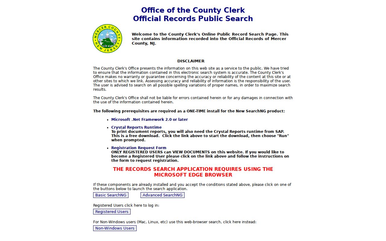
Use the displayed search modes to document the instrument and legal parcel first, then request an image or copy through the applicable Clerk route when the record is needed.
Lawrence Township Permit Addresses
Lawrence Township's FastTrack permit portal adds a property-activity layer to a street search. The accessible screen supports address fields including street number and name, city, postal code, block, and lot, along with permit, violation, application, contractor or agent, inspection, and certificate context. It can help distinguish an address form or locate a dated permit record. Full inquiry requires an account, and the research did not confirm an all-history result set for every Lawrence Township address.
For a record that is not visible online, use a narrow request that names the street, block and lot, date range, and record type. A targeted request under the New Jersey Open Public Records Act, N.J.S.A. 47:1A-1 et seq., gives the custodian enough detail to locate a file while leaving protected information for lawful redaction.
Lawrenceville Labels and Lawrence Records
Older address research can look inconsistent when it is actually using different geographic labels. A 2013 Lawrence Township meeting record discussed the shift toward Lawrence or Lawrence Township while older mailing lists continued to use Trenton 08648. That postal history did not move a civil boundary. A deed and tax search should remain tied to Lawrence Township, Mercer County, and the block and lot, even when a directory, notice, or mailing line uses Lawrenceville or Trenton.
The Township's current street, election-district, zoning, and historical 1776, 1875, and 1978 maps can help compare an old road label with the modern street. No official Township-wide renumbering date or annexation project was found. Treat an unexplained address change as a research question, not as proof that the parcel moved.
Lawrence Township Criss-Cross Trails
A street directory can reach back through historical address books without claiming a current contact. The Princeton Public Library local-history guide identifies Princeton-area city directories on microfilm from 1901 through 1935, Polk Princeton print runs from 1916-17 through 1982 with gaps, wider phone books, and area criss-cross editions that include Lawrenceville. Their coverage is not a complete Lawrence Township annual series, so cite the title, edition year, page, and address spelling used.
Criss-cross books work from address to a historical name or business listing. Pair a volume with the parcel's deed date or an assessor record rather than treating a single entry as continuous history. The historical shelf is covered in greater depth in the Lawrence Township city directories collection.
Note: An absent name in one volume can reflect that edition's area or coverage, not an absence from Lawrence Township.
Lawrence Township Street Records
A complete address search uses the source whose key matches the question. The table separates the evidence each Lawrence Township route can provide from the inferences it cannot support. Record a source date whenever a search returns information, especially when comparing a map, an assessor output, and an older directory.
| Address-keyed source | What it can show | Access route |
|---|---|---|
| MOD-IV Street Index | Recorded owner, assessment fields, mailing and situs distinctions, and parcel identifiers. | Lawrence Township assessor report, terminal, or office route. |
| NJGIS parcel map | Parcel geometry, block or lot context, and map layers. | Public statewide map, with hosted owner names redacted. |
| Mercer deed index | Recorded parties, transfer history, legal description, and instrument references. | Free index, login-gated images, Records Room, or copy route. |
| FastTrack | Permit or inspection status and address-related activity. | Portal search, account for full inquiry, or a targeted OPRA request. |
| Criss-cross directories | Historical address entries. | Princeton Library local-history and reference materials. |
For a Lawrence Township address, preserve the source date beside each parcel, permit, and recording result. That small record trail prevents a map layer, transfer, or directory entry from being treated as a current fact.
The Owner-Map Myth
Myth: a county parcel map is an unrestricted Lawrence Township owner directory. Mercer County's Property Information Portal says its digitized land-development material is incomplete and that anonymous and registered public access is currently closed because of Daniel's Law. The statewide NJGIS route remains available for parcel geography, but it redacts owner names in hosted parcel, tax-list, map-service, and application data.
That access change does not erase the underlying records. It changes the route: assessors and MOD-IV reports provide the public assessment path, the Clerk provides recorded instruments, and an office request may be needed for a defined document. Avoid treating a blank owner field or a closed portal as proof that no record exists.
Lawrence Township Voter Checks
The state registration-status tool is for an identified person's registration and status, not a public street roster. The inspected research did not capture a live result screen, so do not assume a street, ZIP, or bulk-address filter. Lawrence Township belongs in Mercer County for election records, while a Lawrenceville postal label is not a substitute for the civil municipality field.
For registration questions or a form, the Mercer County Superintendent of Elections is at 640 South Broad Street, first floor, Trenton, NJ 08611, and lists 609-989-6750. The office is open Monday through Friday, 8 a.m. to 4 p.m. A narrow status check can confirm only the official result for the identified query; it cannot establish everyone associated with an address.
Lawrence Township Street Limits
A Lawrence Township street directory cannot establish every person connected to an address. An assessor record identifies a recorded owner and may carry a correspondence address. A deed identifies parties to a recording. A permit can identify an application or agent. A map shows a parcel. Each is useful only for that named fact. DMV personal information is restricted, voter fields have protected portions, and ACP or Daniel's Law protections can require suppression or redaction.
For property-fraud monitoring, Mercer Property Alert accepts block and lot or party-name variations after account confirmation. It is free and can alert on a matching recording, but it does not prevent fraud or prove the identity behind a document. Note: Keep a dated worksheet that labels each result as a parcel, recording, permit, voter-status check, or historical directory entry.